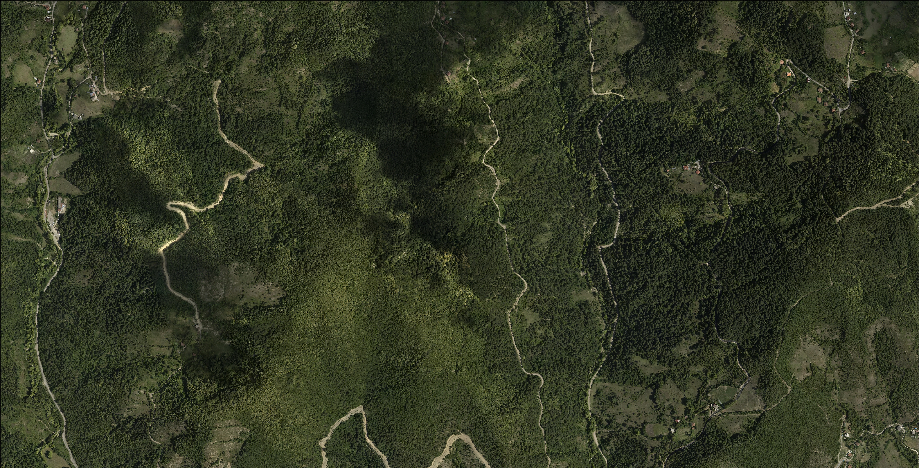
Before
 After
After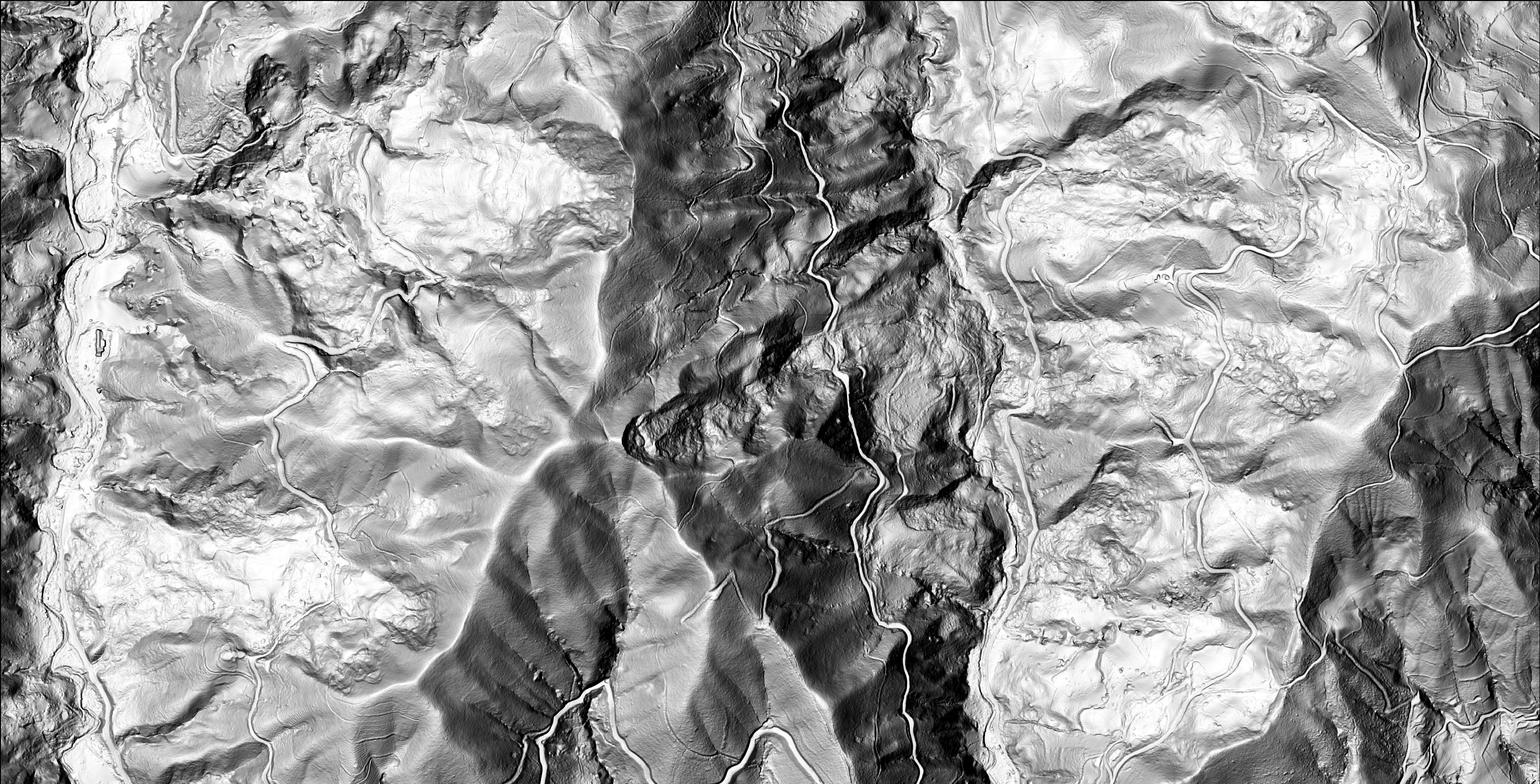
A precise, accurate and complete landslide inventory is indispensable for the establishment of reliable landslide susceptibility and hazard maps. In the preparation of landslide inventories, dense vegetation cover is the major obstacle that confounds the topographic signature of landslides. Today, the growing usage of light detection and ranging (LiDAR) technology in the field of geoscience illuminates the mystery of the landscapes cloaked in dense vegetation by providing a new visual acuity to researchers.
Despite the country-wide medium-scaled landslide catalogs, the number and the abundance of landslides covered by forests remain largely unknown regardless of the increasing availability of high-resolution remote-sensing data. From these motivating insights and drawbacks, the study’s focus is to evaluate the capability of mapping landslides by visually analyzing airborne LiDAR DTM derivatives and compare the results with the 1:25,000 scaled API-based inventory to understand the potential contribution of LiDAR technology in Europe's deadliest country (Turkey) in terms of landslides.
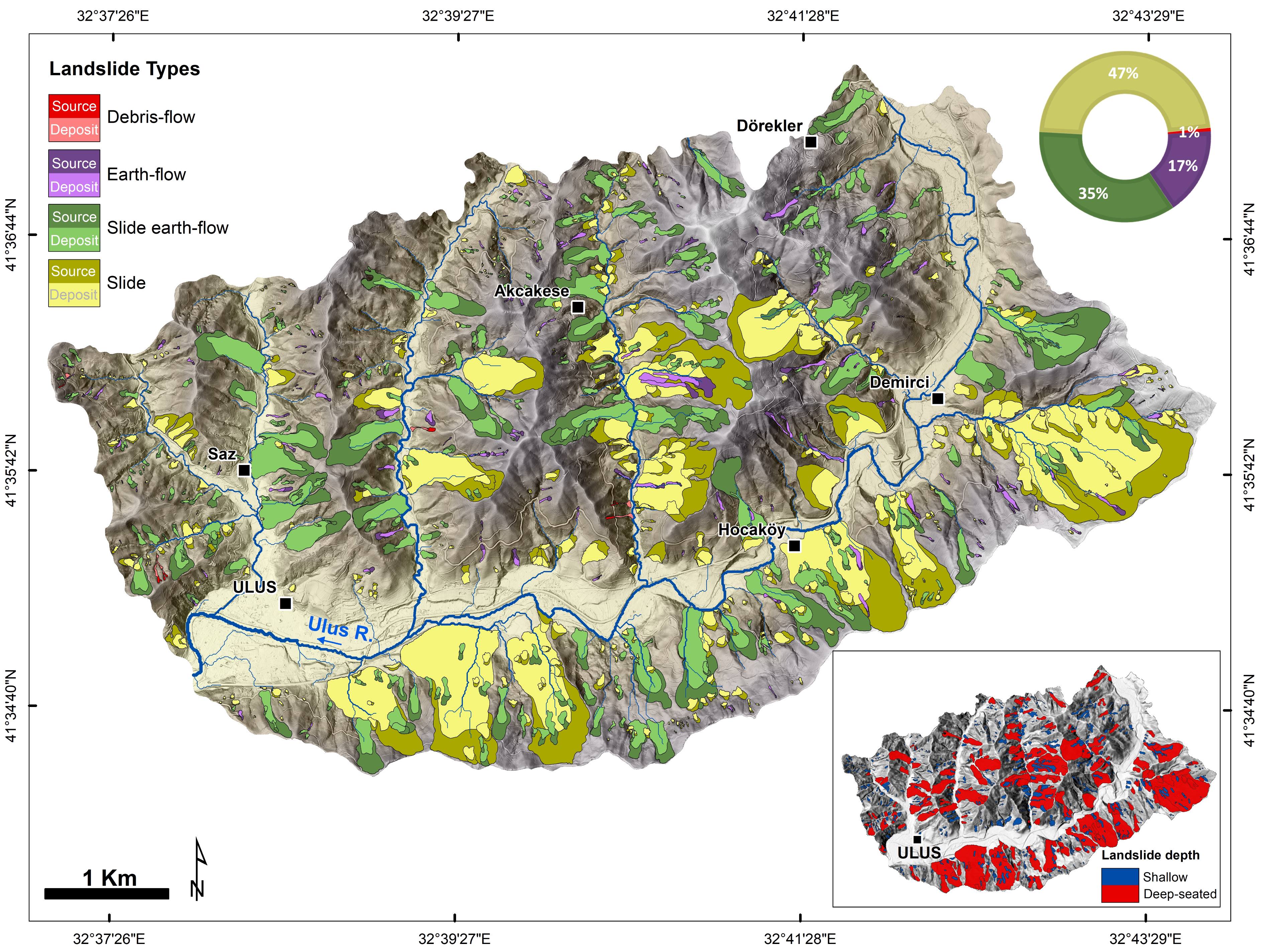 Figure. LiDAR based landslide inventory (n= 902) map of the Ulus (Bartın) Basin, NW Blcak Sea Region, Turkey. Landslides types are classified based on Cruden and Varnes (1996) classification. The pie graphic (right upper panel) shows the number of each landslide types in percentage (Note the graphic colors are associated with the colors of main landslide types indicated in the legend bar). The inset map (right lower panel) shows the distribution of shallow and deep-seated landslides.
In addition to underlining the contribution of LiDAR technology to the recognition of landslides hidden under dense vegetation, our findings stress the importance of LiDAR data on complete and accurate landslide inventories for production of reliable susceptibility and hazard maps and further a better understanding of the landslide processes and reducing related losses.
Publications related to this research:
Görüm, T., (2019). Landslide recognition and mapping in a mixed forest environment from airborne LiDAR data. Engineering Geology, 258, 105155, https://doi.org/10.1016/j.enggeo.2019.105155