One of the most essential parameters of sustainable development and industrialization is uninterrupted energy transmission. Mass movements in the energy transmission line route are surface processes that threaten the continuity of energy transmission. In this context, geomorphological hazard assessments on energy transmission line routes are important.
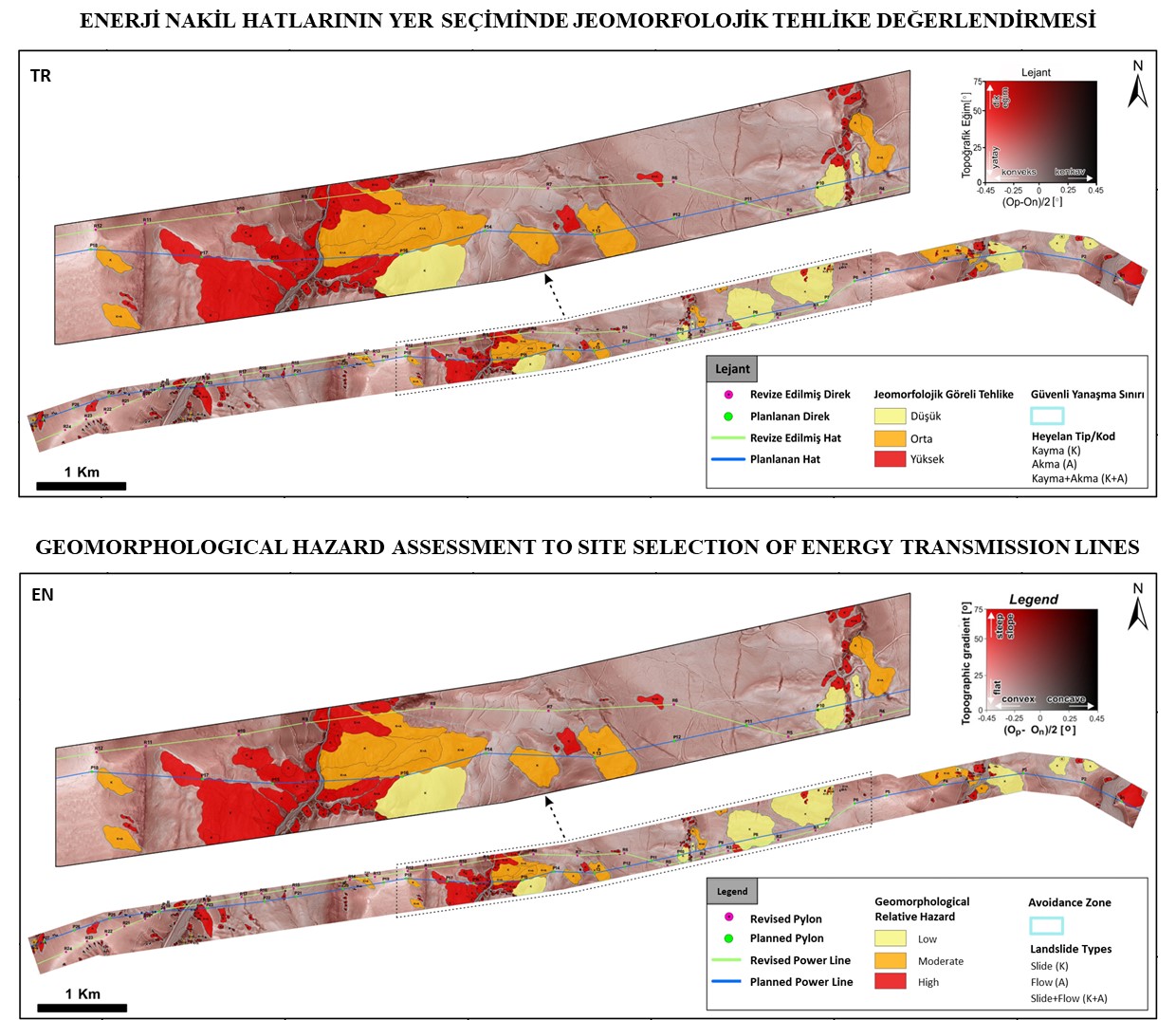 Figure. Landslides and geomorphological relative hazard classification on the energy transmission line route.
In our studies, LiDAR (Light Detection and Ranging) point cloud data is used in geomorphological mapping and assessment in order to eliminate the limitation related to vegetation and to provide high spatial resolution. As a result of the classification of LiDAR point cloud data, Digital Elevation Models (DEM) with high spatial resolution are produced. Landslide inventories are created by using these Digital Elevation Models. Finally, avoidance zones are determined as a result of the assessment made depending on the attribute information such as type, volume, depth and hazard defined in landslide inventories.
As a result of geomorphological mapping and assessment studies, decision support is provided to the planner in the measures that can be taken depending on the mass movements in the planned or operated Energy Transmission Lines.