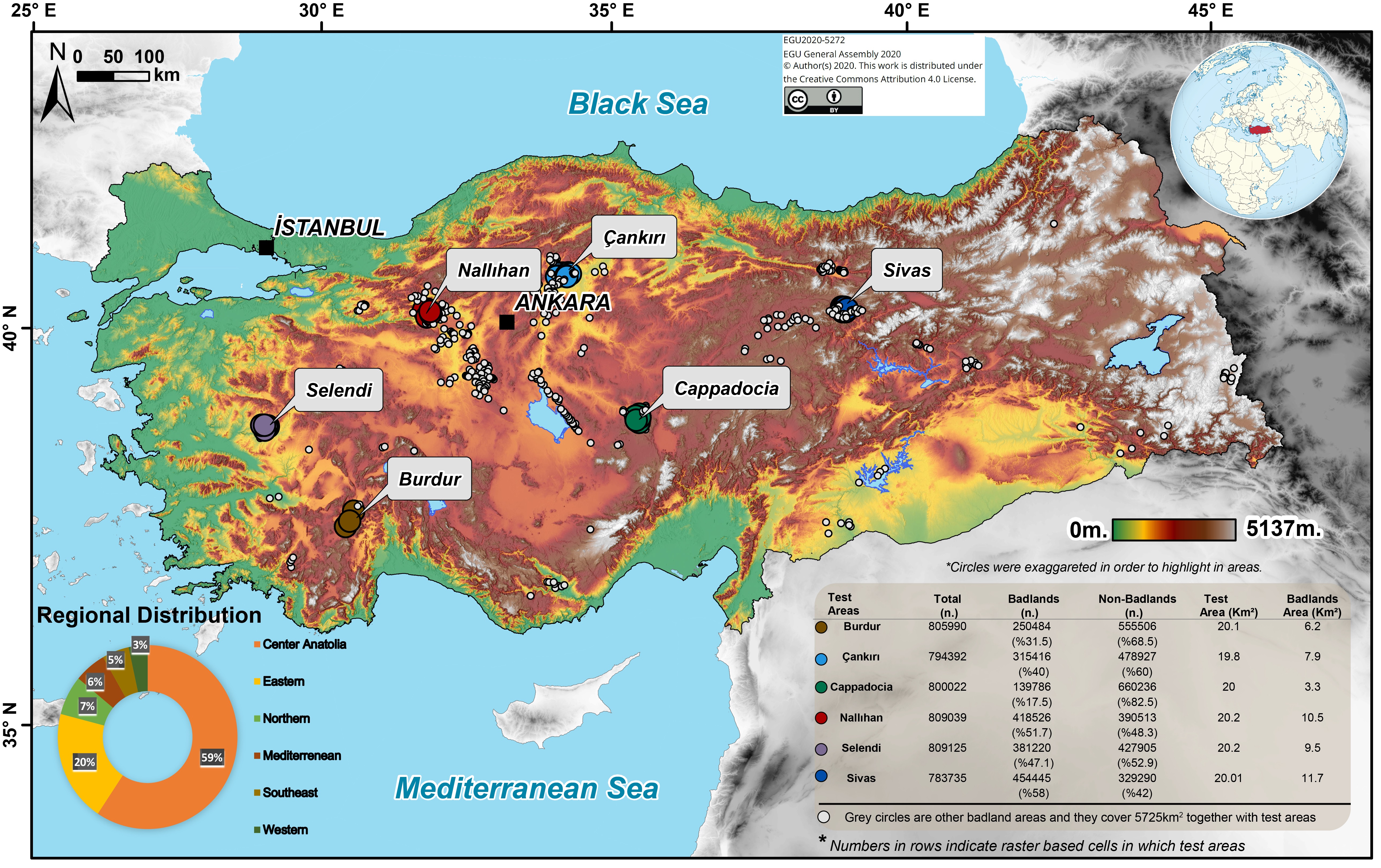
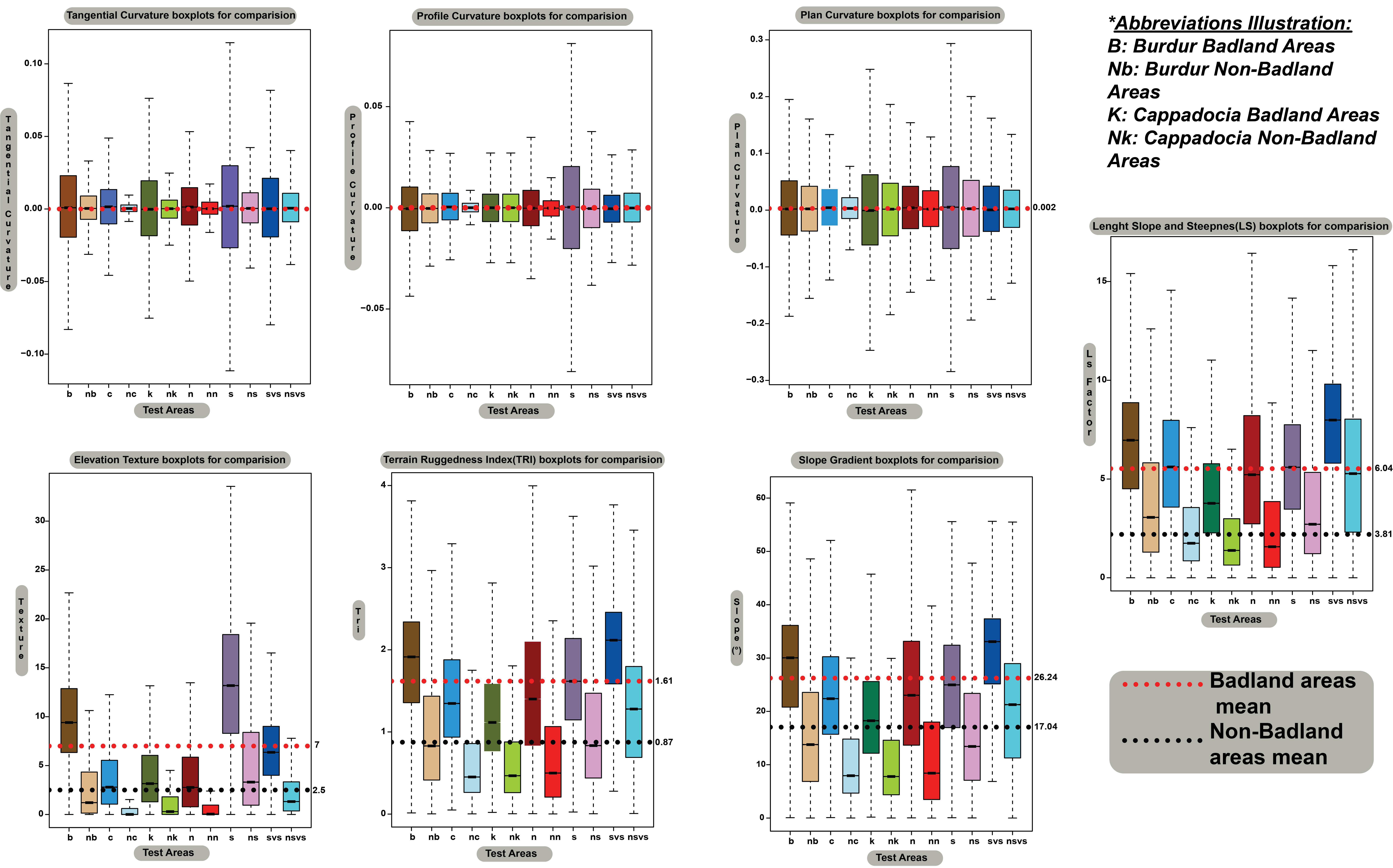
Badlands are unique landscapes that are extensively developed on unconsolidated sediments or poorly consolidated bedrocks that are covered by little or no vegetation. They are widely observed landscapes in Turkey similar to arid and semi-arid regions of the world. Turkish badlands are commonly formed on Miocene and Plio-Quaternary deposits, especially in the inner parts of Anatolia. Additionally, these erosional landscapes are also characteristic in the volcanic provinces of Central Anatolia and Eastern Anatolia. Unlike the cognatic badland landscapes in the different arid and semi-arid sections of the world, we have very limited information about the geomorphological characteristics of Turkish badlands. In this study, we present results from a quantitative analysis of a new inventory of badland areas (~5880 km2) at six major badland landscapes in Turkey. The regional comparison results display statistically significant topographic differences concerning their proportions of morphometric classes. Topographic curvatures do not reflect significant statistical differences in badland and non-badland areas. However, slope gradient and related morphometric derivatives (i.e., LS, Texture, TRI) bear clear signatures of badland and non-badland areas.
 Figure. The distribution of major badland areas in Turkey.
 Figure. Nallıhan Badlands
 Figure. Multiple comparision of test areas in terms of applied geomorphometric analyzes
Highlights:
- Turkish badlands areas (5880km2 ) observed in arid and semi-arid regions and mostly in inner Anatolia (~%60).
- Slope Gradient, Length Slope and Steepness (LS), Elevation Texture, and Terrain Ruggedness Index (TRI) mean plus standard deviations and mean values differ from non-badlands topography on the terrigenous clastic and volcano-sedimentary lithological units.
- Standard deviation is the most representative value of local topographic variables for discrimination in badlands and non-badlands areas.
Abstracts and presentations related to this research:
Avcioglu, A., Görüm, T., Yetemen, Ö., & Moreno de las Heras, M. (2020). Geomorphometric characteristics of major badland landscapes of Turkey. EGU General Assembly. Vienna.