Landslides stand out as one of the most important disasters after earthquakes in our country's geography, considering the damage they cause (Görüm and Fidan, 2021). They need to be monitored at regular intervals and evaluated in land planning due to the losses they cause on human life and economy.
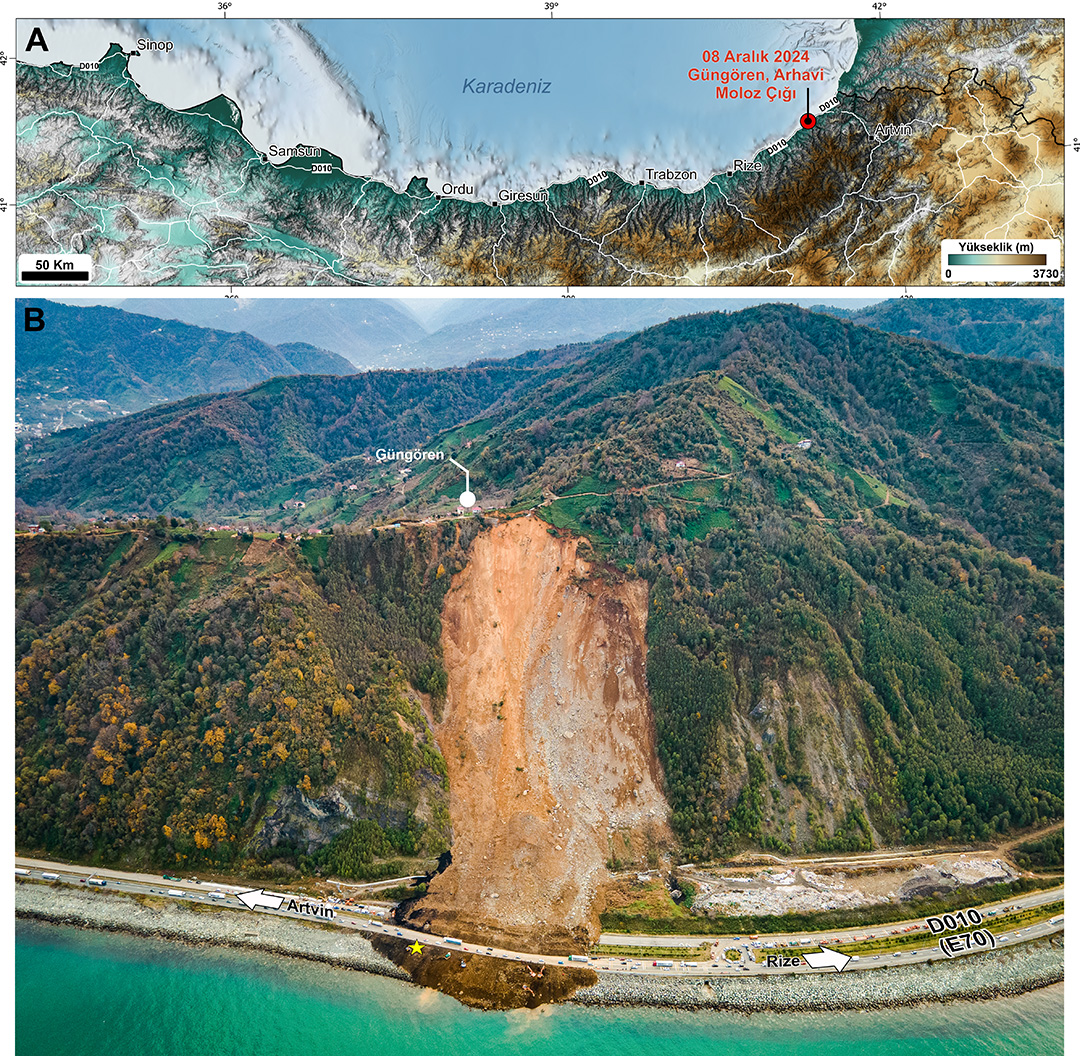
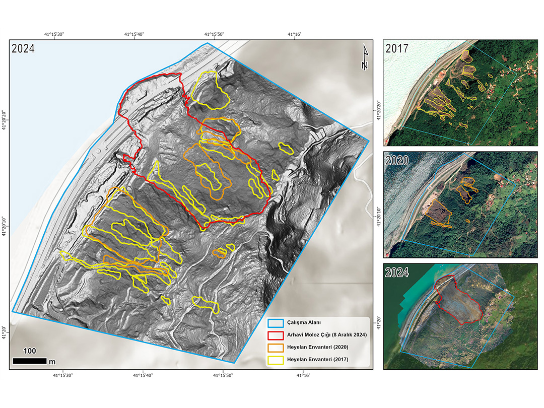
Debris avalanche, a type of landslide that occurred in Artvin's Arhavi district at 03:05 in the morning on December 8, 2024, caused the death of four people and the closure of the Black Sea coastal road, an important highway, to traffic in both directions. This mass movement, which takes place with the movement of the material with a volume of 100 thousand 57 cubic meters in the direction of the slope from the 287 meter high slope, is also important in that it is one of the most predictable of the fatal landslides experienced in this region. As a matter of fact, many landslides have occurred in the past in and around the area where the debris avalanche took place, and it has been observed that crack systems developed in the crown area of the landslide before the event.

ITU Geohazard Research Group carried out field studies in the days following the landslide. As a result of field observations and measurements, the formation of the debris avalanche, its geological and geomorphological characteristics, the existence and characterization of current and past deformations based on InSAR, the triggering mechanism and possible hazards and risks after the event were discussed. This research was turned into a comprehensive scientific-technical report and published on January 10, 2025.

The published report highlights two critical points in detail. The first of these is the necessity of preparing detailed and comprehensive landslide inventories in Turkey using technologies such as LIDAR. The landslide inventories to be prepared should form the basis for planning in public institutions and organizations. The second important issue is the preparation of the landslide inventory in accordance with current classifications and international standards; it is necessary to evaluate landslide activity by monitoring residential areas, roads and critical infrastructures. In this regard, national monitoring and early warning systems must be established.
For detailed information about the landslide that occurred in Arhavi on December 8, 2024, called the Güngören Landslide, you can access the scientific technical report prepared by the ITU Geohazard Research Group from the link.
Reference:
Görüm, T., & Fidan, S. (2021). Spatiotemporal variations of fatal landslides in Turkey. Landslides, 18(5),1691-1705